Elgin Deanery
Birnie
{Brennath}
Parish Church: OS Ref: NGR NJ 207587 H.E.S. No: NJ25NW 1 Dedication: St Brendan / St Moluag
Associated Chapels: (none known)
In charters Birnie can be found referred to as - Brynneth, Urynneth, Brynnath, Brennach, Birney, Brenoth, Birnethe, Brenath, Bryneth and Bruneth! In the Gaelic, 'brenoth' means 'brae or high land' and this obviously relates to the site that the muinntir occupied on top of a rise.
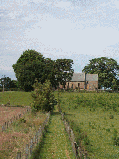
Of the ancient (some say Culdee) foundation there is now no trace which may be the result of it having been a wooden construction. However, Birnie is considered to be one of the oldest churches in Scotland to have been in continuous use for worship throughout its history. But it is something of an enigma since there is little, if any, evidence in the historical record that can tell us with certainty to which Saint it was dedicated. A number of sources give St Brendan (the Navigator) as the titular but without any substantive evidence to support the claim. Other writers suggest that its dedication was to St Moluag which is, of course, possible. A little to the north and just to the east of Elgin itself there is an ancient Barony which bears the name Kilmalemnock - in the 16th-century it seems to have been held by members of the Innes family5 - the name is believed to mean 'Church of Moluag'. The ancient parish of St Andrews
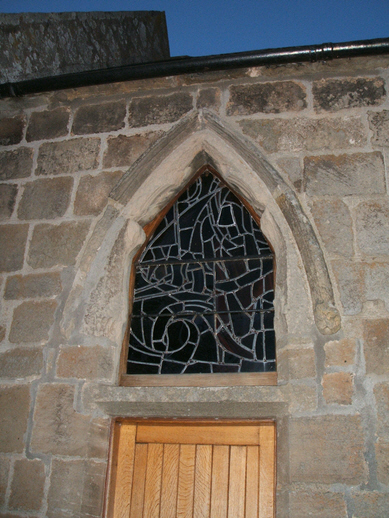
Parts of the present building, most notably the chancel arch, are twelfth-century work of a very fine kind reflecting the fact that the ancient church was built in 1140 on the site of the 6th century Celtic Foundation. Without doubt, it is one of the most superb examples of Norman architecture preserved in Scotland. It seems very ordinary from the outside and, indeed, there has been much restoration, but within it retains a very present sanctity with its Norman chancel and chancel-arch and overall proportions. This early work is of square, dressed, freestone ashlars that are thought to have been quarried at one of the many quarries on the coast near Hopeman.
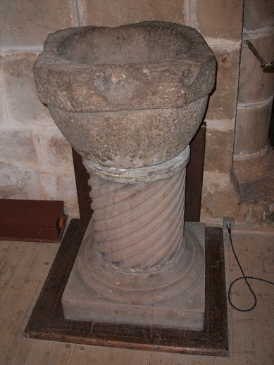
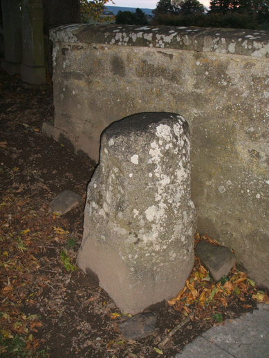
Within the church there is an ancient square 'Saint's Bell', known as the Coronach Bell or Ronnel, and a font which may have come from the earlier church which stood here before the Norman structure was built. The antiquity of the site is underlined by the presence of a seventh-century granite Class I symbol-stone, bearing the eagle and Z-rod symbols, and four fragments of Class III stones (which have been lost in modern times). The oval shape of the surrounding churchyard wall is typical of an Early Church foundation.
The 'fame' of this site has been enhanced greatly in recent years by the findings produced during a long-term excavation project of a settlement found in a neighbouring field to the east of the churchyard. However, the church's 'credentials', too, were enhanced by a building survey carried out in 2011 which, "clarified its complex building history and revealed more of the medieval fabric than had been anticipated, including what is possibly a blocked piscina."4
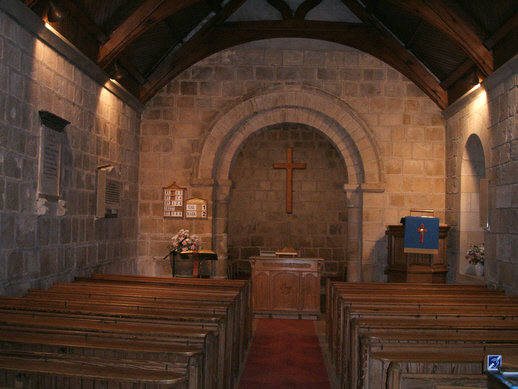
Birnie was one of the earliest churches used by the Bishops of Moray as their cathedral when the Diocese was founded by King Alexander I. in 1107-15. Indeed, it is the traditional burial site of Bishop Simon de Tosney (Tonei) (1171-1184), one of the earliest bishops of the young diocese. From certain of its architectural features, it is reasonable to assume that the first stone church here was built not later than 1140. But when the very first church was built, which would have been constructed of wood, mud and wattle, is not known with any certainty. By the time of Bishop Bricius (1203-1222), Birnie was a mensal church. Bricius attempted to grant it to Kelso Abbey1 but his plans failed and Birnie remained a mensal church up until 1331, when Bishop John Pilmuir (1326-1362) assigned it as a common church of the cathedral, the revenues to be used for the support of the cathedral's many chaplains. In 1350 (2 Id. June) Pope Clement VI confirmed the bishop's gift of the church of Bruneth to part-support 17 perpetual chaplains in the cathedral.2 This supplication to the Pope was issued by the Chapter of Elgin Cathedral on 18 October 1331, in the time of Bishop John de Pilmuir. As such, it is an interesting piece of evidence showing the speed with which such matters were dealt with in these early years: it had taken nineteen years for the pope to grant his permission, although the de facto use of Birnie to support the chaplains probably took place much earlier in anticipation of permission being obtained from the Curia.3
Not very far from Birnie church - about 1.25km in a south-easterly direction - lies the site of the Palace of Birnie at Castlehill
Old Hill Road passing Birnie.
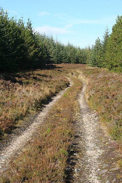
Many scholars have raised their eyebrows when considering the location of the first centre of ecclesiastical authority in Morayshire. "Why at Birnie?" they ask. Recent archaeological discoveries have revealed that a considerable centre of population existed here from the very earliest of times. But many have missed what a study of the topography would have quickly revealed to them. Birnie was, in fact, on one of the main routes through Morayshire. We must remember that the extensive marshes immediately to the east of Elgin (such as that at Barmuckity), and those around the flood-plain of the River Lossie to the west of the town, made transport at times very difficult, if not impossible. What was required was a route which lay in the higher ground to the south of Elgin. Even a casual study of the Ordnance Survey map reveals that there was a very important route from the west at Rafford
The route east from here is still traceable from the present road-system as it runs directly past Birnie Church, passing The Level
© Anne Burgess
The bishops held the lands of Birnie as a secular Barony in its own right, but, on 8 November 1451, it was incorporated into the great Barony & Regality of Spynie erected by King James to encompass all of the scattered posessions of the bishop into a single entity, with stunning quasi-regal secular powers.
At the Second Reformation (1560), the lands and church of Birnie passed from the Crown to the Earl of Moray. In later times they were in the possession of the Earls of Findlater and the Earls of Seafield.
| Name | OS Grid Ref. | Rental | Held by | Comment |
|---|---|---|---|---|
| Glenlaterach & Blairnhall | NJ 200547, NJ 198548 | £72.2.2 | Earl of Findlater | |
| Middleton, Gedloch & Connloch | NJ 204547, NJ 227551, NJ 222548 | £193.15.0 | Mr Leslye of Findracie | |
| Dykeside | NJ 209589 | £69.9.4 | William King of Newmiln | |
| Hilhead | NJ 203584 | £115.8.4 | William King of Newmiln | |
| Rashierook & Castletoun | NJ 224573 | £50.0.0 | William King of Newmiln | Rashcrook & Castlehill? |
| Tomshill | NJ 214576 | £78.0.0 | Earl of Findlater | |
| Slankhouse | NJ 207592 | £102.0.0 | Earl of Findlater | Stank House |
| Boggs | NJ | £32.10.8 | Doctor David Brodie | |
| Smiddy Crofts | NJ | £6.16.6 | John Donaldson, Elgin | |
| Brewers Croft | NJ | £6.16.6 | William Laing of Birnie | |
| Information from Morayshire Land Tax Rolls8 with locations added by David Murray. | ||||
Clergy:
(none known at this time.)
1. Kelso Abbey was a Tironensian house and Bricius had been Prior of Lesmahagow, before becoming bishop. Lesmahagow was a Tironensian 'daughter' house of Kelso Abbey. This may suggest that Bricius had been first at Kelso as a monk.
2. Registrum Ep. Moraviensis, no.227, p.290
3. It should be remembered, however, that Europe was in the throes of the 'Black Death' from 1347, resulting in the death of between one-third and two-thirds of the population.
4. Braby, A. and Romankiewicz, T. Birnie Kirk, Moray (Birnie parish), standing building recording. Discovery Excav Scot, New, vol. 12, 2011. p.122
5. There is a Freemasons Lodge in Elgin which bears the Name "Lodge Kilmolymock No. 45". This is the same name - Kilmalemnock.
6. Yeoman, P (1988) 'Mottes in Northeast Scotland', Scot. Archeol. Review, vol.5, 1988. 131, 132.
7. There was a lot of illicit distilling in this area. At Whitsunday, in 1811, Cardow (Cardhu Farm) near the south end of the Mannoch Road was leased by John and Helen Cumming. It is said that Helen Cumming, whose husband was three times convicted for illegal distilling, each week walked barefoot along the road over Mannoch Hill carrying the brew to sell in Elgin. It is also recounted that the couple would sell their produce, which was famed for its mellow flavour, through the farmhouse window to passing travellers! [Heritage Paths] accessed 27/10/19.
8.Morayshire Land Tax Rolls, volume 3, (1773). E106/14/3/3 accessed 26/06/21. Although these Rolls are post-medieval in date it seems reasonable to include them here in the belief that the names of property/land will not have changed significantly.
e-mail: admin@cushnieent.com
© 2019 Cushnie Enterprises
