Elgin Deanery
Logie Fythenach
{Edinkillie}
Parish Church: OS Ref: NGR NJ 019465 H.E.S. No: NJ04NW 19 Dedication: St John Baptist.
Associated Chapels: Bridge of Ess {NGR NJ 008460}; Tullidivie {NGR NJ 00_ 49_}; Logie {NGR NJ 006508}.
The name of this parish is given variously as Edenkellie, Logie Tytherach, Edinkelye and Logyfythenach. Quite regularly it is also called Brae-Moray.
Thomas Owen Clancy has recently published a paper in which he forensically investigates the place-name Logie and comes to the conclusion that it signifies an "ecclesiastical site".1
The eminent historian Lachlan Shaw was of the opinion that, "most parts of this parish was anciently a forest." He derived this opinion from the fact that, in a charter of King Alexander II, dated 11 September 1236 and given at Dissington, in Northumberland, the king gave Andrew de Moravia, Bishop of Moray, three dabhaichean of Finlarig

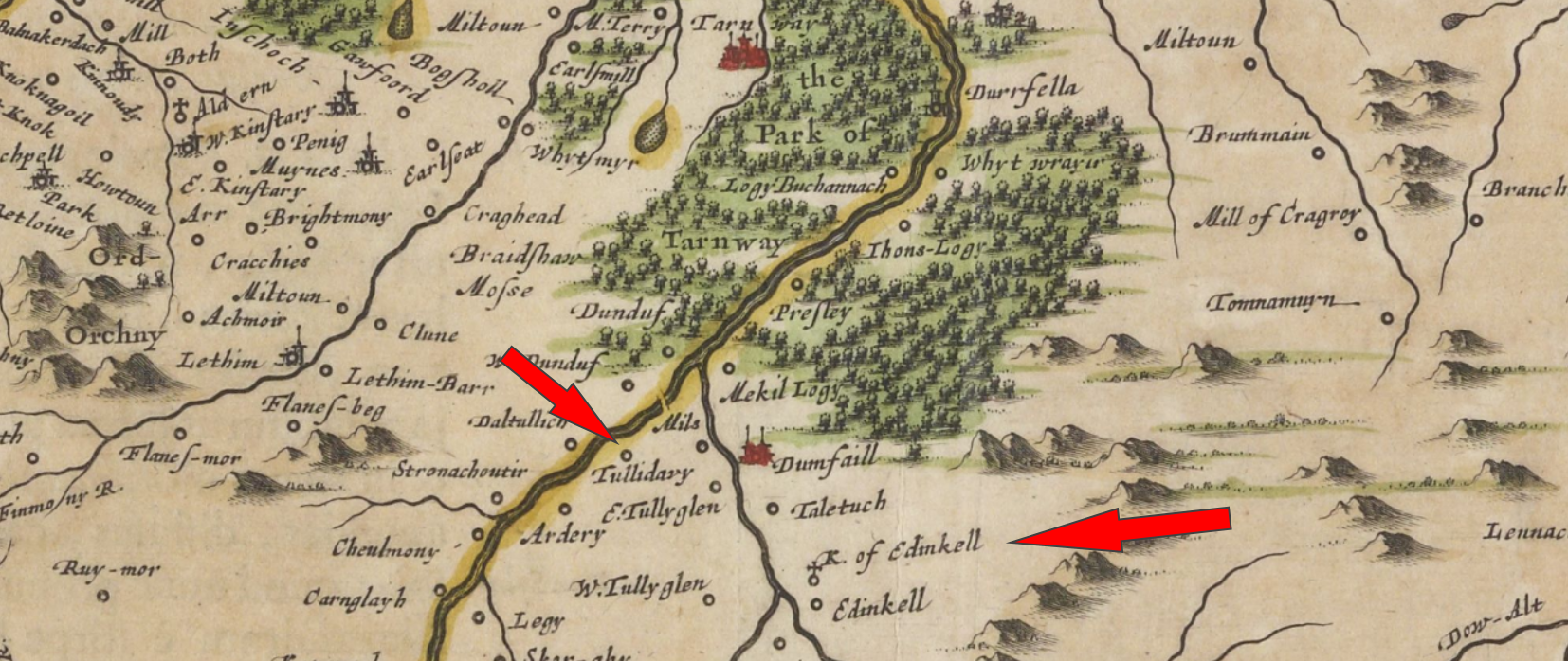
© NLS Maps.
Hew Scott, in his monumental Fasti Ecclesiae Scoticanae, comments that "Edinkillie was of old a vicarage".6 This is, in part, true but this is because, from 1207x1208, Edinkillie, (along with Forres), formed part of the prebend of the Archdeacon of Moray. This arrangement required the Archdeacon to make provision for both of these churches and, at Logie, this resulted in him appointing a vicar pensioner to serve the cure. But this did not imply that Logie was not a parish in its own right, it meant simply that the rectory and the rectory tithes were held by the archdeacon. Consideration of the charter evidence (see below) seems to indicate that the church lands were always in the possession of the bishops of Moray, but there is no certainty in this.
The patronage of the church was held by successive earls of Moray and, during these early times, the only village in the parish was Conicaval
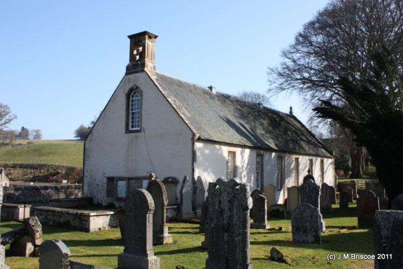
The present church was built in 1741 and 'improved' in 1813. The parishes of Edinkillie and Dyke were con-joined in 2018.


On Chapel Hill, about 1.5km east and slightly north of the present parish church, there is a significant collection of clearance cairns and hut-circles, and it is also said that, previously, there were two standing stones here. Local 'lore' tells us that 'the Danes' had a temple here and that it was this that gave the hill its name.7
| Name | OS Grid Ref. | Extent | Including | Comment |
|---|---|---|---|---|
| Brae Moray | NJ 00_42_ | 1d. | ||
| NJ 011418 | Kno(c)k | |||
| NJ 000438 | Culferne | |||
| NH 996419 | Kerrowgear8 | |||
| NH 991407 | Auchadare | |||
| NH 981397 | meikle Aitnach | |||
| NH 974363 | Lochindorb | Forest & Castle | ||
| Drummine | NJ 020518 | 1d. | ||
| Phorp | NJ 050522 | 1d. | ||
| Meikle Phorp | NJ 050522 | 0.5d. | ||
| NJ 044513 | Craigroy | |||
| Thomnacronyeane | ||||
| Thornn | ||||
| NJ 048504 | Anlouschak | Auldusack | ||
| NJ 050508 | Burntack | |||
| NJ 041501 | both Thomnamoons | Tom-na-Moine | ||
| NJ 050514 | Broylak | Brylak | ||
| NJ 026514? | Hillock | |||
| Little Phorp | 2p. | |||
| unnamed | NJ 000508 | 0.5d. | in Forest of Darnaway | |
| Information from Ross (2003).9 | ||||
1208-15 Magna Carta of Bishop Bricius records that the Archdeacon had the churches of Forres and Edinkillie as his prebend. [Moray Reg., no.46]
1215 (22 December) Pope Innocent III writes to the dean and chapter of Moray giving his approval for the arrangements made by Bishop Bricius regarding the composition of the chapter at the cathedral. He makes a point of taking into his special care, various churches, including that of Logynfythenach. Given at the Lateran, 11 Kalends Jan. [Moray Reg., no.47]
1236 (11 September) King Alexander II granted 3 dabhaichean of Finlarg, and Logie, "ad capellanum solitarium sustentandum" [Moray Reg., no.37]
1288 (25 February) Charter of Archibald, bishop of Moray, in which he gives the lands of the church of St John Baptist of 'Logynfythenach' to John, archdeacon of Moray, on condition that he will appoint a chaplain who is to celebrate mass in the said church for the souls of King Alexander and his antecessors and successors, Bishop Andrew and his successors, and all the faithful of Christ. He adds that Archdeacon John will also secure, for the sustenance of the chaplain, an annual payment of one mark from the vicar of Dyke, whoever he may be at the time, to be paid half at the feast of St Martin, and the other half at the feast of Pentecost nearest following. [Moray Reg., no.222]
1369 (6 January) King David, king of Scots, gave his beloved and faithful Richard Comyn, all the lands of Develly (Dalvey?), with the office of forester of his forest of Darnaway, in the earldom of Moray in the sheriffdom of Inverness; in feu and heritage, of us and our heirs, for service owed and accustomed. [RMS, i, no. 285] This was, most probably, Sir Richard Comyn of Altyre (d.1407).
1529 (11 May) Robert Fleschar, Vicar of Edinkillie, in a charter detailing the endowments of the altar of St Duthac in the parish church of Elgin, is mentioned as being a land-owner in the town. [Records of Elgin, Vol. 1, p.44]
Bridge of Ess. A number of sources speak of there having been a chapel at the Bridge of Ess where there was a crossing point over the Dorback Burn
It is significant that chapels were positioned at points where a stretch of water was to be crossed, and there is a causal relationship between this idea and the superstitious beliefs of the people of the time towards water. Water was always held by these people to be 'dangerous' since it was the home of sprites and spirits and other evil entities. The crossing of a river, by either a ford or ferry-boat, was not a matter to be taken lightly and, very often, chapels were built on one or other side so that the traveler could either pray for a safe crossing or give thanks after having made a safe crossing. It was the same with mountain passes, where one can often find a chapel at both ends of even remote paths. This is often the explanation for the situation of chapels in otherwise very isolated locations.
Tullidivie. It is recorded in the Fasti ecclesiae Scoticanae that there was a chapel at Tullidivie.12 Although it is not marked on modern OS maps, Tullidavy is shown clearly on the maps of both Joan Blaeu (1654) (see above) and Timothy Pont (ca.1583-1601). This chapel is thought to have been located near to the ancient Doune of Relugas which recent archaeological excavations have produced radio-carbon dates of the 4th/3rd century BC from the lower occupation layers.13 It would not be surprising to find that there was a chapel at such an ancient site.
Logy Fythenach. The charter of Archibald, bishop of Moray, (see above) clearly records that this church was known as "the church of St John the Baptist of Logyfythenach". We have shown that it is most probable that the location of the first parish church was at Logie, not at Edinkillie. But our problem is not solved by this since the place-name 'Logie' is to be found in a number of locations locally, as recorded in the old maps of the area: the Park of Logie Buchannach;14 16 Buchannach;15 Jhons-Logy;14 Mekil Logy;16 Ihons Logy;16 Loggie.17 Of particular note here is Logie Buchannach which seems to embody a link to the ancient landholders. The Comyn family were the owners of Darnaway and Dunphail before the king gave much of Darnaway to the Randolph family. The chief of the Buchan family, Buchan of Auchmacoy, owns a church to this day, just over the River Ythan from his House of Auchmacoy, which is called Logie Buchan
The question then remains as to which of these Logy place-names relate to the old parish church. Conclusive evidence is yet to be found but I would suggest that the location known as "Jhons-Logy" and "Ihons Logy" carry a link to the name found in the charters - "church of St John the Baptist of Logyfythenach". Certainly, they agree very well with the description of lying on the east bank of the River Findhorn.
1386 (4 December) Adam was chaplain of Dyke and witnessed a charter by Alexander, Bishop of Moray. {vide supra.} In the same charter we find Alexander Brodie being appointed perpetual vicar of Dyke in succession to John son of Colin who had resigned.
1. Clancy, Thomas Owen (2016) 'Logie: an Ecclesiastical Place-Name Element in Eastern Scotland', Journal of Scottish Name Studies, 10, 2016, 25-88, note 23, p.45. http://eprints.gla.ac.uk/135558/1/135558.pdf (Accessed 24/03/2021) Return
2. The parish lands run from Lochindorb in the south, northwards until it reaches its boundary with the parish of Dyke. Anciently, these lands were held by generations of the Comyn family, who exercised their power from the castle which they built on a loch in Lochindorb itself. Return
3. RMS, i, no. 285. Charter dated 6 January 1369, given at Dundee. Return
4. Blaeu, J. (1654) Theatrum Orbis Terrerum, sive Atlas Novus, Vol.5; Scotice et Hibernia. Amsterdam. Page(s): Moravia, Scotiae provincia. https://maps.nls.uk/view/00000464 (Accessed 26/03/2021) Return
5.Pont, Timothy (ca.1583-96) Moray and Nairn, Pont 8, manuscript [Adv.MS.70.2.9 (Pont 8)]. National Library of Scotland (NLS) Maps. https://maps.nls.uk/view/00002297 (Accessed 26/03/2021) Return
6. Scott, H. (1926) Fasti Ecclesiae Scoticanae, Vol. 6, Edinburgh: Oliver and Boyd, 418. https://archive.org/details/fastiecclesiaesc06scot/page/418/mode/1up?view=theater (Accessed 25/03/2021) Return
7. See the CANMORE database https://canmore.org.uk/site/15753/dallasbraughty (Accessed 24/03/2021) Return
8. Kerrow: from the Gaelic Ceithreamh (pronounced Kerrow), a quarter. It was a custom in olden times to divide the land in divisions, and the fourth part of that division was called a Ceithreamh or quarter. This custom is believed to have been first instituted during the time of the Columban monks, and carried on until the beginning of the eighteenth century. Return
9.Ross, A.D. (2003) The Province of Moray, c.1000-1230, unpublished PhD thesis presented to Aberdeen University, Vol 1, 62; Moray Reg., no.40, p.35. Return
10. CANMORE database https://canmore.org.uk/site/15752/ess-bridge (Accessed 26/03/2021) Return
11. OS Morayshire Name Books, 1868-1871, Morayshire, volume 23. OS1/12/23/90. https://canmore.org.uk/site/15752/ess-bridge (Accessed 26/03/2021) Return
12. Scott, H. et al (eds.) (1915-61) Fasti ecclesiae Scoticanae: the succession of ministers in the Church of Scotland from the Reformation, Revision. Edinburgh. Vol. 6, 418. https://archive.org/details/fastiecclesiaesc06scot/page/418/mode/1up?view=theater (Accessed 26/03/2021) Return
13. CANMORE database. https://canmore.org.uk/site/15755/doune-of-relugas (Accessed 26/03/2021) Return
14. Blaeu Atlas Maior 1662-5, Volume 6: Moravia Scotiae Provincia. NLS Maps. https://maps.nls.uk/view/108520509 (Accessed 27/03/2021) Return
15. Blaeu Atlas Maior 1662-5, Volume 6: Scotiæ provinciæ mediterraneæ. NLS Maps. https://maps.nls.uk/view/108520500 (Accessed 27/03/2021) Return
16. Pont, Timothy (ca.1583-96) Moray and Nairn, Pont 8, manuscript [Adv.MS.70.2.9 (Pont 8)]. National Library of Scotland (NLS) Maps. https://maps.nls.uk/view/00002297 (Accessed 26/03/2021) Return
17. Roy Military Survey of Scotland, 1747-55: Strip 27, Section 3c. https://maps.nls.uk/geo/roy/#zoom=14&lat=57.5446&lon=-3.6431&layers=0&point=57.5352,-3.6696 (Accessed 27/03/2021) Return
18. RRS, vi, no.277. Dated 12 September 1362 at Aberdeen. Return
e-mail: admin@cushnieent.com
© 2021 Cushnie Enterprises

