Elgin Deanery
Knockando
{Aberbrandely}
Parish Church: OS Ref: NGR NJ 186428 H.E.S. No: NJ14SE 1 Dedication: St Brendan.
Associated Chapels: Cardow {NGR: NJ 191433}; Crofthead {NGR NJ 23_42_}; Kirdals {NGR NJ 175397}; Pulvrenan {NGR NJ 203422}.
The identification of this parish's name is a little confused. Some scholars say that it is to be identified with Aberbrandely whilst others refute this. Since there is no evidence which directly contradicts that the two names are one and the same place, we have, to begin with, adopted this line of approach here. To add to the confusion, over the ages, different scribes have given various 'phonetic' spellings of the name as they heard it spoken, such as, Knocandoch, Knokaynoch, Knokeandoch, Knokendocht, Knockandoch, and Knoknyndoche.1
In addition, because there are two Pictish Symbol stones and also a Rune Stone kept at the present parish church, many readers have been mislead into thinking that this was the location of the ancient church.2 The stones, however, were moved here in about 1820 from their original location in the grave-yard at Pulvrenan.3 It is at this latter location that the very earliest church seems to have been founded and dedicated to St Brendan.
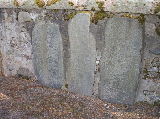
As we have said, at some point, the church was moved to Upper Knockando, most probably from Pulvrenan
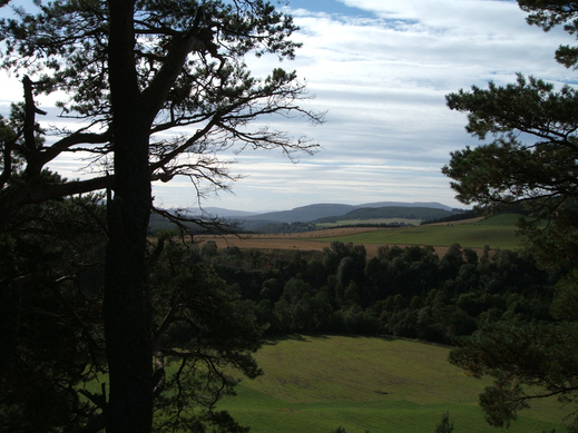
However, in general, the medieval history of the parish of Knockando is very obscure. As we have already said, most scholars accept that Knockando is one and the same as Aberbrandely, which name is found in a number of charters, and that it may have once been a 'pendicle' of Invera'an parish church. But nothing regarding this possible association with Invera'an is certain. The name Aberbrandely, in the form Abberbrandolthin Brenin, is first encountered c.1200 as one of the lands in Stratha'an.4 This, in itself, presents us with a problem since the lands of Invera'an are located on the opposite side of the River Spey from Knockando. However, much of the land in Invera'an was held of the king by the bishops of Moray, as were large parts of what became the parish of Knockando - principally the small barony of Kirdells and most of the lands of the barony of Knockando - so it is not outwith the bounds of possibility that all of these lands, on both sides of the river, were administered, in both a secular and an ecclesiastical sense, by the same 'authority'.
We have noted that much of the land around Knockando was church land - most particularly the southern part around Kirdells.5 Indeed, there is still a location named Bishop's Croft about 500m north-west of the bridge at Blacksboat
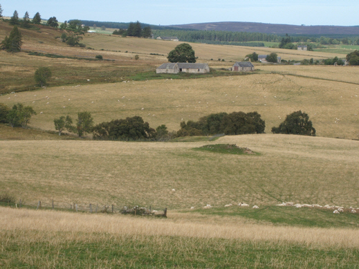
(The 'cairn' in the field in the middle of the picture is said to be the location of the chapel.)
Knockando was the southern-most parish in the Deanery of Elgin, the neighbouring parishes - Aberlour (to the east, over the River Spey), Invera'an (south-east, over the Spey), and Inverallan (south-west, and on the same side of the Spey) - were in Strathbogie, Strathspey deaneries respectively.
Knockando's important link with the ecclesiastical 'power-base' at Elgin is amply demonstrated by the existence of what, for generations, has been called the Mannoch Road. It leads directly from Knockando, northwards over Càrn na Cailliche, to the Episcopal 'Palace' and church of Birnie. There then follows the Glenlossie Road which takes the traveler from Birnie directly into Elgin via the lands of Mayne. Place-names along the route of the Mannoch Road reveal its ancient pedigree - Shian na Mannoch
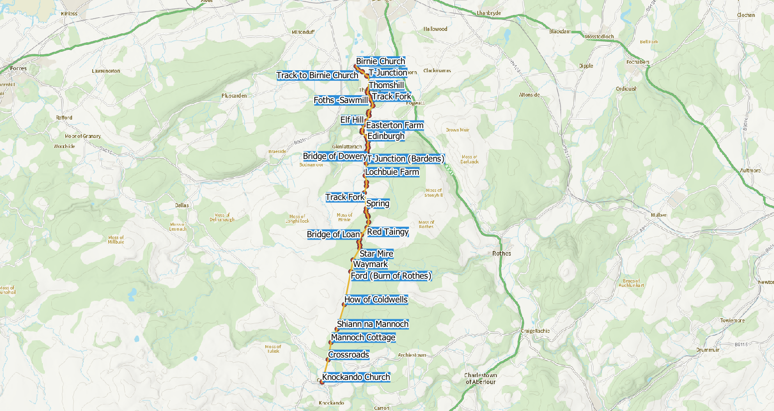
(An interactive version of this map is available HERE.)
Having been known since antiquity, it may be reasonable to suggest that the Mannoch Road was, indeed, a 'Pictish road' since it is known that there were Pictish communities at both Knockando (Pulvrenan) and Birnie. In more recent times the Road became famous for the number of illicit stills that were to be found scattered amongst the peat-hags on either side of its route. This, in turn, gave rise to a very active smuggling trade in the locality! The Mannoch Road is an excellent prospect for hill-walkers and ramblers, and further details of the route are published on the Heritage Paths website.
The lands around Knockando seem to have been church lands from a very early date. We see from the first and second of the charters noted below that, in 1350, the Countess of Moray, Isabella Randolph, widow of the first Earl, Thomas Randolph,6 having already disposed of half of her lands of Aberbrandely to the earl of Fife in 1349, then used her remaining half to endow a chaplainry in the cathedral of Moray in memory of her late husband. We learn a number of very important things here: that the lands she had inherited after her husband's death included what was then known as Aberbrandely; that this land of Aberbrandely had been divided into two parts; that she had used the 'half' of Aberbrandely which she had retained to endow a chaplainry in the cathedral, the chaplain to serve at the altar of the blessed Thomas the Martyr; that the lands of Aberbrandely were held of the bishop and chapter.
But there is another vital fact here that becomes clear from the charters relating to this cathedral chaplainry: it was known as the Aberbrandely, or Knockando, or Broadland chaplainry, in recognition of the lands from which it derived its income or financial support.7 It has proved to be very difficult to identify the lands known as Broadland. However, a close inspection of one of the sheets of Pont's Maps 9 shows Broidland immediately to the east (downstream) of the "Kirk of KnockAndich" which, of course, is Knockando church. In my view, this evidence regarding the chaplainry proves that Aberbrandely was equivalent to those lands known as Knockando and Broadland which were the source of finance for the cathedral chaplainry in question. It is important for us to note that we are talking here about lands, not parishes or parts of parishes. It is quite acceptable to assume that, at certain points in their history, these lands were the property of the same principal who also happened to possess (large) parts of Invera'an, without it having to mean that Knockando (Aberbrandely) was ecclesiastically part of Invera'an parish.
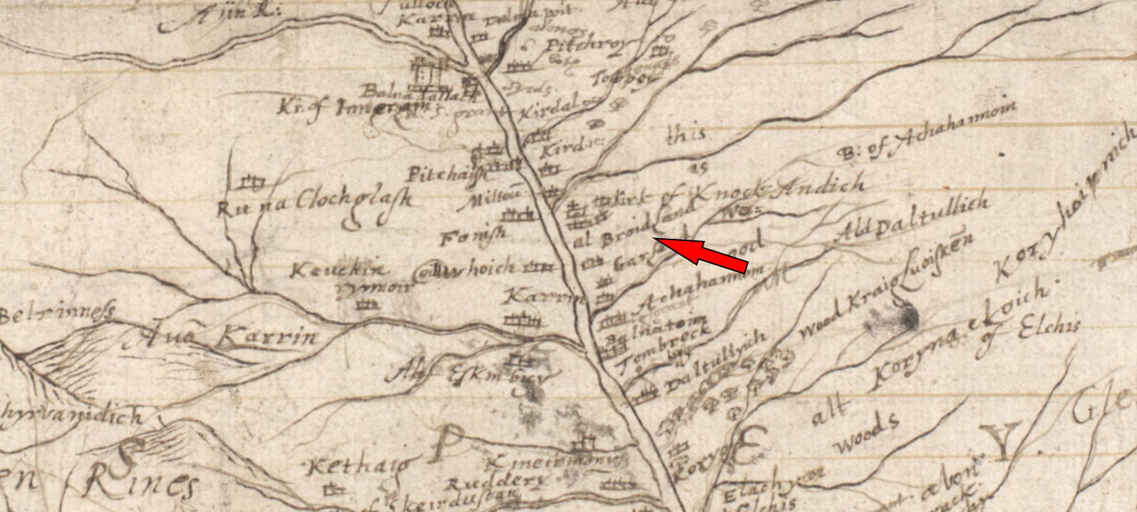
We have already quoted a post-Reformation charter of the then Laird of Freuchie which gives us details of the cathedral chaplainry of St Andrew (see Note 7 below). This first charter was given on 19 May 1643. Nearly thirty years later, on 21 December 1671, the new laird of Freuchie, Ludovick Grant, who is about to marry Janet Brodie, daughter of Alexander Brodie of Lethen, signs a marriage contract which lists the lands which she is to receive from her intended husband. These lands are given in more detail below (see see Note 8 below) but, most importantly, they include those "pertaining to the chaplainry of St Andrew."
| Name | Including | OS Grid Ref. | Extent | Comment |
|---|---|---|---|---|
| Knockando | 1 dabhach | |||
| Lyne | NJ 176452 | |||
| Aldavenie | NJ 171454 | Aldavonnie. | ||
| Balniglach | NJ 164452 | Probably the same as Balnegeick. | ||
| Knockaniglan | NJ 163433? | |||
| Clune | NJ 148451 | |||
| Kerkdow | NJ 192431 | Cardow. | ||
| Logiemulloch | ||||
| Cardanach | NJ 195424 | |||
| Tamair | ||||
| Knockechins | ||||
| Cowlack | c. NJ 124442 | |||
| Kirdells | 2 dabhaichean | |||
| Mains (of Kirdells) | NJ 179400 | |||
| Bishop's Croft | NJ 177393 | |||
| Over & Nether Kirdellbeg | NJ 174411 | |||
| Glenarder | NJ 164416 | |||
| Tomnaleugle | NJ 172412 | Tomintuigle | ||
| Tomblea | NJ 174404 | |||
| Knockanlick | ||||
| Rinour | NJ 171407 | |||
| Ballintuime | NJ 178386 | Balintomb. | ||
| Pitcroy | NJ 179385 | Pitchroy. | ||
| Delnapott | NJ 171370 | |||
| Achinenie | ||||
| Cladich | ||||
| Chappell Croft | ||||
| Bordland | c. NJ 20_42_ | 1 dabhach | Brodland or Broadland. | |
| Glenrunie | half dabhach | |||
| Information from Ross (2003)10 with locations added by David Moray. | ||||
The reader might be interested in a 'modern' article written by one who was born in Knockando in 1880. He locates some of the cottages, farms, and other features, as he remembered them when he went back to visit his old haunts after retiring from many years of service in the London Police.
c.1200 Agreement (compositio) reached between Richard {of Lincoln}, bishop of Moray, and Duncan {Duncan II} earl of Fife regarding a number of half-dabhaichean of land in Strath Avon. The earl will hold his lands in Stratha'an of the bishop during his lifetime, rendering 2s. at each of Martinmas and Pentecost.
Also, the earl will hold from the bishop, two half-dabhaichean of Invera'an after the death of Brice, the parson there, rendering 4s. on the same terms.
Also, the earl will hold Advie, rendering 40 stones of cheese at Martinmas.
The earl will hold the full court of the bishop in those lands and fully perform the forinsec service due to the king from those lands. [Moray Reg., no. 16] [SEA, i, no.114]
1349 (2 February) William, dean of Moray, testifies that Isabella, countess of Moray, has sold half of her lands of Aberbrandely with its possessions, both now and to be had in the future, to the noble lord, the earl of Fife. To which things the whole chapter of Moray appended their signatures in the Chapter House of the cathedral on the feast of the Purification of the Virgin Mary, 1350 (1349-50). [Moray Reg., 229]
1351 (16 July) Isabella Randolph, countess of Moray, with the assent of John, bishop of Moray and the dean and chapter of the cathedral, founds a perpetual chaplainry in memory of the mighty lord Thomas Randolph, sometime earl of Moray and her late husband, and for the souls of herself, her family, and all her friends who celebrate in the church of Moray. And for the sustenance of the chaplain she gives 100s. sterling per annum of the rent, for all time to be received, that is to say seven marks from the fermes and commodities of half the land of the church of Abirbrandely which she had sold to the noble lord Duncan, earl of Fife, which land was held of the bishop, dean and chapter of Moray. The chaplain is to behave as all the other chaplains have done since antiquity and to keep the canonical hours and to say mass at the altar of the blessed Thomas the Martyr and he is to say mass every week in the chapel of the Blessed Virgin Mary in the castle at the altar of St John the Baptist for which he was to receive 3s. 4d. for wax, bread and wine for the aforesaid altar of St John Baptist, and another 3s. 4d. for 'ornamenting' the said altar. In addition, the countess gave to every canon, vicar, and chaplain, who were present in choir at the yearly mass to celebrate her 'anniversary', and to provide for the bread, wax and wine required for the purpose at the altar of the blessed Thomas the Martyr, seven marks to be taken up from from the aforesaid half of Aberbrandely, to be divided equally amongst them. Witnessed and signed by the bishop, dean and chapter, in the 'canoniam' (chanonry/chapter-house) at Elgin. [Moray Reg., no. 232]
Cardow
Crofthead
Kirdals
Pulvrenan
The Ordnance Survey Name Book has an interesting note to add, that "attempts were made to restore or rebuild the Church upon the site in question {at Pulvrenan} and the 'opposing party' got it removed to near the site of the present parish church."15 The surveyor also noted that the dedication of this church was not known. There is a suggestion here that the party who wished this church to be rebuilt, but who had to be satisfied with one being built instead near to the parish church, were not of the same denomination as those who attended the parish church, i.e. they were not Presbyterians. Might they have been the remnant of a Roman Catholic congregation? The Survey was carried out in 1868-71 but the surveyor gave no indication of when this proposed rebuild at the Pulvrenan site was mooted. The surveyor's notes conclude with the observations that this was, "the site where the old parish Ch [Church] stood, said to have been an ordinary building thatched with straw. The date is unknown, but [it] is supposed to have been the first Christian place of worship in the Parish."16
Macdonald & Laing wrote that the placename derives from a salmon pool on the River Spey known as Pool Veriner which is probably Poll Bhreunainn (St Brendan's Pool).17
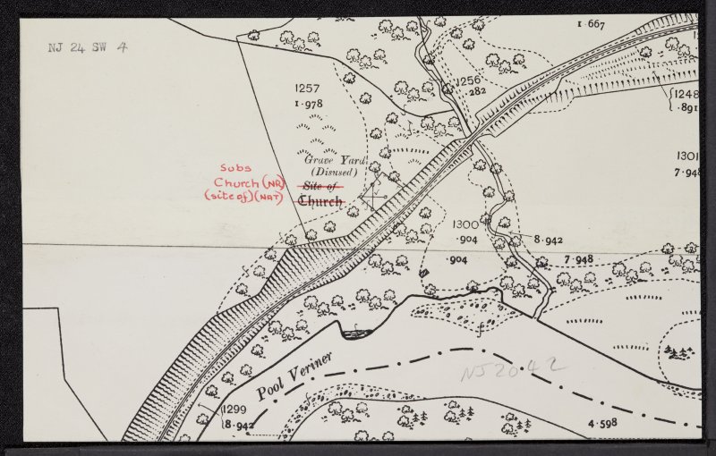
and the section of the River Spey known as "Pool Veriner".
1. Fraser, Wm. (1883) The Chiefs of Grant, Vol. 3, Edinburgh. Listed in the 'Index' at the end of this volume, p. 587. Return
2. The three carved stones are described in many references. That at Moray Historic Environment Record (HER) is particularly good. Return
3. CANMORE Database http://canmore.org.uk/site/16042 Return
4. Taylor, S. (ed.) (2008) 'The Lost Place-names of Moray', in, Journal of Scottish Name Studies, Vol. 2, 11-18. The charter in question [SEA, I, no.114] refers to Abberbrandolithin and Brenin as apparently two separate entities, each of one half dabhach.
See also POMS https://www.poms.ac.uk/record/source/4014/ Return
5. This barony of Kirdells is not to be confused with that of Kerdale which was the property of the de Moravia family in the high-medieval period. Kerdale is in what is now called Dunmaglass
5b. Young, Robert (1879) Annals of the Parish and Burgh of Elgin: from the Twelfth Century to the Year 1876, Elgin: Private Publication, 703. Return
6. Thomas Randolph was a nephew of King Robert the Bruce. He had an outstanding career as a soldier and diplomat and, on the Bruce's death, became Regent of Scotland since the heir to the throne was still a minor. He died on 20 July 1332 at Musselburgh whilst leading an army to repel the forces of Edward Balliol. His wife Isabella died only a little time after giving the second of the charters noted above. Having inherited the lands of her husband, she sold (in 1349) half of her lands of Aberbrandely to the then earl of Fife, but the charter made it clear that the lands were held, both by the Countess and the Earl, of the Bishop of Moray. [Moray Reg., no. 229] This agreement was renewed between the bishop and Earl Malcolm I in 1223 x 1228. [Moray Reg., no. 62] Return
7. The cathedral chaplainry in question was known as the Chaplainry of St Andrew. "… the lands of Knockandoch and Glencumrie, alias Knockandoch, pertaining to the chaplainry of St Andrew, founded within the cathedral kirk of Moray, with the pendicles and fishes thereof upon the water of Spey, and with the corn, waulk mills, mill lands, multures, and sequels of the same, withing the barony of Strathspey, regality of Spynie, and sheriffdom of Elgin and Forres; with the lands of Brodland, pertaining to the chaplainry of St Andrew, otherwise called Brodland, founded in the cathedral kirk of Murray, with the pendicles and fishings, etc., of the same, lying as before stated; the whole of these lands to be held by double infestments, the one of James Grant of Freuchie and his heirs in free blench for yearly payment of one penny upon any part of the lands above referred to, at Whitsunday, in name of blench farm, if asked; the other infeftment to be held from James Grant of Freuchie and his foresaids of their immediate superiors of the lands and others above mentioned, in feu-farm, for the yearly payment to them of the duties for the lands of Over Finlarg alias 'Muckrothe' {Muckrach} with mill thereof, Mid Finlarg and Nether Finlarg, with their pertinents, for the fe-farm, mairts, and custom oats thereof, amounting altogether to the sum of £22 16s. money of the realm." Given at Forres, 19 May 1643. {The James Grant of Freuchie mentioned here was married to Lady Marie Stewart, who was the sister of the Earl of Moray.} [Fraser, Wm. (1883) The Chiefs of Grant, III, 456-458.] Return
8. The lands in question were (amongst others): "… the lands of Knockandoche and Glencumrie, sometime pertining to the chaplainry of St Andrew, and otherwise called Knockandoch, founded of old in the Cathedral Kirk of Moray; with the parts, pendicles, and fishings thereof on the water of Spey; the lands of Broadland, belonging to the same chaplainry, with the parts, pendicles, mills, mill lands, multures, woods fishings, and other pertinents, in the barony of Strathspey, regality of Spynie and sheriffdom of Elgin and Forres; the two lands of Knockandoch and Glencumrie, comprehending the towns and lands of Nether Borloum, Over Borloum, and Mid Borloum called Kerkdow, Lagmulloch, and Drumgilbon, lands of Lyne and Glencumrie, Auldwinnie, Craigingloshen, Knockannes, Lechindarroche, Garrowlinemoir, Garrowlinebeg, Clune, Over Tomdow, Nether Tomdow, Walkmylne, the Walkmylne Croft and other crofts called Permaphoyes Croft, Martines Croft and Croft Laggan, with the pertinents before referred to …" [Fraser, Wm. (1883) The Chiefs of Grant, Vol. iii, 469-470.] Return
9. Pont, Timothy (ca. 1583-96) Strath Spey - Pont 6 (front). NLS Maps https://maps.nls.uk/view/00002294. Return
10. Ross, A. (2003) The Province of Moray, c.1000-1230, unpublished PhD thesis presented to Aberdeen University, Vol 2, 42. Return
11. CANMORE Database https://canmore.org.uk/site/16066/cardow Return
12. Mackintosh, H.B. (1924) Pilgrimages in Moray: a guide to the county, Elgin, 109. Return
13. ibid. 110. Return
14. OS Name Book, OS1/12/16/133. Return
15. ibid., OS1/12/16/49. Return
16. ibid. Return
17. Macdonald & Laing, 'Early Ecclesiastical Sites in Scotland, Part II', PSAS 102 (1969-70, 129-45), p. 141. Return
e-mail: admin@cushnieent.com
© 2021 Cushnie Enterprises
